
Turning LiDAR Into a Scaled 3D GIS View of an Industrial Piping Facility
Client: Global Chemical Manufacturer Operating an Extensive Industrial Piping Facility
Challenge
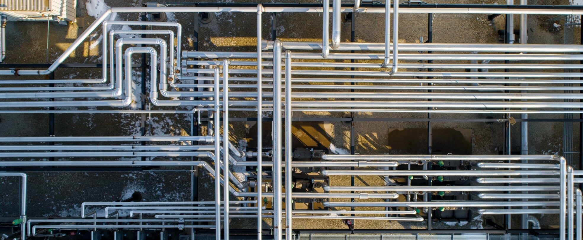
A global chemical manufacturer needed a clearer way to view and work with above-ground piping spread across more than one mile of pipeline in pipe racks and meter runs. The facility contained stacked lines, elevation changes and closely spaced components that were not possible to represent accurately in a standard 2D map. A point cloud could capture that complexity, but the raw data alone would not give most users a simple way to identify individual pipes or locate valves, bends, flanges, tees and reducers. The client needed a usable 3D GIS representation that could bring the survey data and mapped assets together.
Solution
Altamira collected LiDAR across the client’s facility to capture the pipe racks, meter runs and surrounding conditions. Our LiDAR team then processed the survey data using specialized point cloud processing software. The scans were georeferenced, registered and classified to create a consistent point cloud for the full project area.
Using the processed point cloud as a reference, Altamira’s geographic information systems (GIS) team created 3D pipe centerlines in a GIS environment. Each line preserved its horizontal position and elevation. Pipe outside diameter was measured from the point cloud and stored as an attribute, which was used to accurately symbolize each pipeline at its real-world size. The team then mapped valves, bends, flanges, tees, reducers and other pipe features as 3D points.
Altamira also developed a Computer-Aided Design (CAD) model of one meter run and placed it at its correct real-world location within the 3D GIS environment. To make the results accessible, our GIS team created an interactive web dashboard with linked 2D and 3D views. Users could move between an overall facility view and specific assets while viewing the 3D pipe, fittings, CAD model and supporting attributes in one place.
Results
The client received a usable 3D GIS representation of the facility rather than raw point cloud data that required specialized software and expertise to interpret. Altamira converted the LiDAR survey into scaled 3D pipeline features representing more than one mile of pipe rack and meter-run piping. Valves, bends, flanges, tees, reducers and other components were mapped as individual assets. The deliverables also included an accurately positioned CAD model and an interactive web dashboard with linked 2D and 3D views.
The dashboard gave users a clearer way to understand the facility’s piping arrangement without working directly with the point cloud. The 3D view showed pipes to scale based on their diameter and made stacked lines, elevation changes and closely spaced components easier to distinguish. The corresponding 2D view provided a familiar way to navigate the facility and locate individual assets.
Together, the deliverables created an accessible foundation for asset review, project planning, field verification and future GIS development. The client could view the facility’s piping and components in their correct spatial relationships while retaining the underlying GIS data for continued use across the organization.
For more information, please contact Dustin Sanchez, GIS Manager.
Dustin can be reached at [email protected]
Related Services
Empower Your Next Project With Altamira’s Expertise
Whether you’re addressing regulatory requirements, improving asset integrity, reducing emissions or planning critical infrastructure projects, Altamira delivers the technical expertise and practical solutions to help you succeed. Contact our expert team and discover how we can support your operational, environmental and compliance goals.
Contact us today to discuss your project.
